Showing posts with label Wandering. Show all posts
Showing posts with label Wandering. Show all posts
Monday, June 30, 2014
What is Left When the Present is Gone
The road, like life, for which it is such a perfect metaphor, is as much about the past as the present. What remains when the rest of the journey has vanished are the good times, the many moments which made the road worth walking. Much of the labour, the drudgery, is lost to the mind, and only the beautiful, the striking, thecurious, the great, the baffling, the monumental, the surprisingly satisfying, the unexpectedly perfect, is left in the mind.
The 'lubina' I had for dinner in a cider house in Pendueles last night, caught that morning with a line by a man from the village who still makes his living thay way, and grilled to perfection over the charcoal. The bull that blocked our path on the hills near Andrín this morning. Andrín itself, beautifully kept, the newcomers building in the old style, clean and colourful, and with wonderful views of the mountains rising opposite.
The bufones near Llanes, sinkholes in the karstic formations of the area, some almost perfect circles, apparently bottomless cylinders going deep into the earth, throwing out sprays of seawater when the high tide forces its way in and under then.
The river Purón, ankle-deep and clear and cold, running to the sea just there between high cliffs, looking as though it were a thousand miles from the sea, a pure, green, gurgling stream that you cross on an old wooden bridge.
And although it is the road itself that matters, you remember the joy of getting somewhere, when you thought you never would. The path from Andrín to Llanes rose higher and highe and turned ever more away from the town it was supposed to take us too. A strong wind was blowing and I had the feeling we would never arrive, but be forever taunted by the unattainable town we could seen beneath us on the shore, and we would be forever rising and turning away until from fatigue or desperation or dramatic necessity we would reach an edge that we must fall from.
The water at the beach of El Sablón felt that much better this evening, because we had arrived.
Friday, June 27, 2014
On The Road Again...
Yesterday we arrived at San Vicente de La Barquera, a pretty fishing village on the coast of Cantabria, on the Bay of Biscay, and one of favourite places anywhere. The old castle is high on a rock between the two arms of the river,closing and dominating the oldest, walled part of the town. Below is the old port, now with as many small pleasure boats as fishing craft. They come in a great variety of colours, but bright blues, greens and reds are popular, and they are moored not just in the port, but along the seawall, off the bridge and into the estuary. This, and the habit of painting houses in similar colours, those that are'n t made of stone and wood, give a slightly chsotic brilliance to the scene. Behind the port the main street has stone collonades all along it and the buildings are mostly attractive and powerful, looking as though they have always been there and always will be.
Apart from the beauty of the village itself, iit has a long wide beach bounded by high green cliffs, good for swimming and surfing, across the estuary, a short walk over the bridge, and many paths along the river and through other villages or into the hills. By walking beyond the beach up and over the headland you can, in a couple of hours of pathswith beautiful views and details of evrything that makes the area woryh seeing, reach Comillas, where Gaudí has a number of curious structures and Alfonso XII had his holiday palace.
Not too far away are Santillana del Mar, a village that is as it was in the late middle ages, bright and lively in the sun, and still lived-in, the Caves of Altamira, some if the oldest and best preserved of all cave paintings, and the caves of El Soplao, also fascinating to anyone with imagination and an interest in what we once were.
We swam at the beach to refresh the limbs from the journey, then had dinner in the Boga Boga, which is the best place to eat if the reader ever finds himself there. The percebes were caught that morning, the nécora, a kind of crab, was grilled to perfection and the turbot, which had also been happily swimming that same morning before it was suddenly interrupted by a fisherman, was also perfectly done.
It seemed a shame to leave this morning, but we had come to walk, to continue where we stopped two years ago, and so we hoiked on our rucksacks and set off.
The route I had planned took us over the cliffs, through a handful of small villages, past fields of orange and purple cows, horses, donkeys, sheep and very small goats (you don't tend to think of goats as pretty, but these are, especially the kids). When I say fields, I mean any patch of hillside without too many trees that can be fenced off and where a sufficiently expert driver can handle a tractor without sliding backwards into the sea. This is not the broad, flat, dry landscape of Castille.
The village we are in now, in a small and comfortable rural hotel specially built to look as though it has been here forever, is called Pechón and is high on a headland between two of the estuaries which break upthe cliffs every few miles all along this coast. You reach it by walking a couple of miles up a steep road that climbs beside one estuary, and going halfway across the headland. You could also get there by doing something exactly symmetrical from the other side. It is one of the things I like about, pleasing to the mathematical mind.
From the balcony we can see the village below and the see, and the showers sweeping in one agter the other from the north. Green places are green for a reason.
Where the road crosses the ría, before the climb begins, you can look to the left and see, within a hundred yards, the old road bridge, still used for some reason, the bridge where the narrow-gauge railway crosses, and the little station beside it, and high above it, the new bridge where the motorway crosses and buries itself in a tunnel through the hills. And the coloured boats on the water, of course. A living vignette of human movement and ingenuity through the centuries. It should have been a photo, not just a memory, but it started raining at that moment and I got distracted.
Mrs Hickory is always determined to swim, especially on a new beach, whatever the weather and the attendant circumstances. I approve of thishabit in general. This afternoon that meant walking down- down being the significamt word- through a light drizzle to a rocky brach with a dangerous undertow to stroll bravely into the chilly water, do a few strokes back and forth to make it worthwhile, and then trying to get dry in the rain before climbing back up again to the village. This is fun, really it is. The beach is characterful and atmospheric, small and shut in by tough looking rocks, giving you the sense of being alone against the Atlantic and the whole of nature. That's why it's fun.
Blogging by phone, apologies for typos etc
Saturday, August 10, 2013
San Pedra
I walked today along the route of one of the many dry or
almost dry streams in the area. The map is full of blue lines, some full, some
broken, with the words ‘non-permanent water-course’ next to the symbol in the
legend. Many of them have not had water for many years. Some, in fact, are
barely visible on the ground, but are perfectly clear from satellite
photographs, and you wonder where the water has gone that once created these
great channels.
 The stream I took today does have water this year, and when
it doesn’t you can still see where it flows. I particularly like this path
because it takes you between bright red hills covered with bright green
vegetation. The water may be barely visible, but the plants know it’s there.
There is a freshness to it which is very rare here.
The stream I took today does have water this year, and when
it doesn’t you can still see where it flows. I particularly like this path
because it takes you between bright red hills covered with bright green
vegetation. The water may be barely visible, but the plants know it’s there.
There is a freshness to it which is very rare here.
But there is a lot more to the path than a feeling. There
are little stone bridges where it winds back and forth across the water. There
are little cottages used by the men who have gardens there, as sheds are in
England, but some are bigger and become a place of refuge, especially during
the summer. Some are proper houses, two floors and whitewashed walls, and once
families would have lived there all year round, with the chickens and the dogs
and the pig in the corral. Now they are just summer dwellings, quiet, solitary
places which appeal to the owners who still grow crops on the old riverbed.
There is a ruined Moorish castle, little more than a square
turret, rising through the trees on a small hill near where you pick up the
main road again. I saw it once after very heavy rain had turned the hill into
an island, and you see the castle as it was intended to be, unreachable by
stealth, a safe place from which to keep an eye on the surrounding country.
There are a lot of them here.
 From that point you pass a forlorn and empty campsite,
unable for some reason to attract more than a handful of campers, even when at
the other campsites downstream they are queuing to get in the doors.
From that point you pass a forlorn and empty campsite,
unable for some reason to attract more than a handful of campers, even when at
the other campsites downstream they are queuing to get in the doors.
And from there you are beside the lakes. You pass an
attractive hotel, tumbling down the rocks to the waterfront, dressed always in
freshly laundered white, accessorized tastefully in well-kept wood, and adorned
with dabs of red and green and gold in just the right places. You are back
among people, and can then choose to swim, row, take the sun or contemplate the
world at any point along the banks where you can find room.
Thursday, August 8, 2013
Otis tarda
 It could be the name of death metal band (perhaps it is), but I'm referring here to the great bustard, a large bird which has traditionally nested in the south of Spain, and over the last few years is back in increasing numbers. As I cover a lot of ground on my travels, I have seen a few of them this year.
They seem to like some of the farmland near the lakes. They nest on the ground, and they congregate near the centres of large fields (fields are large here because the land is poor and you need a lot of it to grow a worthwhile crop). They avoid the paths where people and vehicles might go. I don’t imagine they can conceive the purpose of paths, of course, but by constantly moving away from any people they do see, they will end up with a preference for a spot in the centre, where they will only be bothered at ploughing, sowing and harvest time (or by the occasional lost wanderer who, having given up hope of finding a path that actually goes somewhere near his goal, and wondering vaguely whether he will be missed at lunchtime, or they’ll have kept his beer on ice, decides to walk straight across on the off-chance that on the other side of the field there is something that is of use to him).
There are rather beautiful birds. Light earth brown on the wings, bordered and finished below in white, they look at first sight a little like emus. They vary greatly in size. Some are like turkeys, but I came across a small group the other day that were around four feet tall. They were only 50 yards when they too flight, and for a moment when I saw them I genuinely couldn’t work out what they were, so impressive was there size. They fly little, but with an elegant, efficient grace which is a pleasure to watch. They are, it is said, the biggest flying things on Earth, and yet they have none of the clumsiness of many ground-nesting birds (watching a partridge fly you wonder if the chap in the workshop in Switzerland who put it together had lunched rather too well).
Whole families stay together until the chicks are hard to tell apart from the adults, so you might suddenly see a dozen of them rise from the corn in front of you are argue briefly about the best direction to take before splitting up and reuniting somewhere beyond the next copse. It is a remarkable sight to see them fly, and they give a different scale to the skies. They make the eagle owls look small and clumsy.
It could be the name of death metal band (perhaps it is), but I'm referring here to the great bustard, a large bird which has traditionally nested in the south of Spain, and over the last few years is back in increasing numbers. As I cover a lot of ground on my travels, I have seen a few of them this year.
They seem to like some of the farmland near the lakes. They nest on the ground, and they congregate near the centres of large fields (fields are large here because the land is poor and you need a lot of it to grow a worthwhile crop). They avoid the paths where people and vehicles might go. I don’t imagine they can conceive the purpose of paths, of course, but by constantly moving away from any people they do see, they will end up with a preference for a spot in the centre, where they will only be bothered at ploughing, sowing and harvest time (or by the occasional lost wanderer who, having given up hope of finding a path that actually goes somewhere near his goal, and wondering vaguely whether he will be missed at lunchtime, or they’ll have kept his beer on ice, decides to walk straight across on the off-chance that on the other side of the field there is something that is of use to him).
There are rather beautiful birds. Light earth brown on the wings, bordered and finished below in white, they look at first sight a little like emus. They vary greatly in size. Some are like turkeys, but I came across a small group the other day that were around four feet tall. They were only 50 yards when they too flight, and for a moment when I saw them I genuinely couldn’t work out what they were, so impressive was there size. They fly little, but with an elegant, efficient grace which is a pleasure to watch. They are, it is said, the biggest flying things on Earth, and yet they have none of the clumsiness of many ground-nesting birds (watching a partridge fly you wonder if the chap in the workshop in Switzerland who put it together had lunched rather too well).
Whole families stay together until the chicks are hard to tell apart from the adults, so you might suddenly see a dozen of them rise from the corn in front of you are argue briefly about the best direction to take before splitting up and reuniting somewhere beyond the next copse. It is a remarkable sight to see them fly, and they give a different scale to the skies. They make the eagle owls look small and clumsy.
Friday, August 2, 2013
At Orëbro
 Mrs Hickory came across this area by chance when she was
looking for somewhere we could go walking well away from Stockholm. There is a
large and beautiful system of lakes nearby, a lot of people have wooden cabins
there for holidays, and so we went for a couple of days to walk around. Cue
photographs of water and birds.
Mrs Hickory came across this area by chance when she was
looking for somewhere we could go walking well away from Stockholm. There is a
large and beautiful system of lakes nearby, a lot of people have wooden cabins
there for holidays, and so we went for a couple of days to walk around. Cue
photographs of water and birds.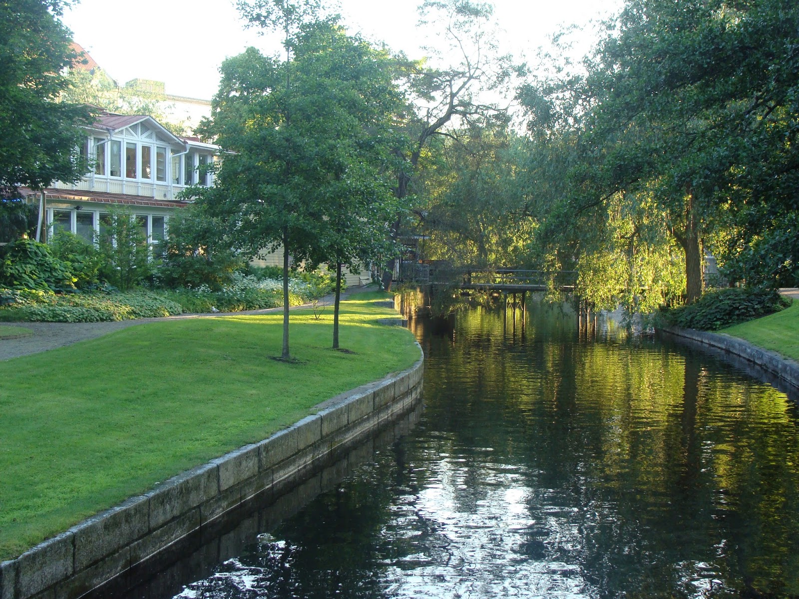
The river runs through the centre of what is only a small
town, really, and it divided and rejoins itself again to form a small island
called Large Island. It’s a matter of perspective, I suppose. The island and
the neighbouring banks are a park, a very green and pleasant one full of
unnecessary bridges and playgrounds and peculiar objects that were part of an
art exhibition. There is a castle on another little island next to it and this
was the view we had from our hotel room, which was across the river. It’s a conference
centre now and inside it looks like one, but it has an impressive presence from
without. A marauding band of brigands or disgruntled thane of lands to the
North would think twice about trying to take Orëbro.
 And bicycles. There are a bicycles everywhere.
Huge numbers of bicycles. Just as in the other cities we saw, but in such a
small place the quantities are exaggeratedly large. Everywhere there are people
riding bikes, but also there are banks and hoards and rows and columns of bikes
parked by the dozen or the hundred on almost every corner and every widening of
every street, in racks intended for the purpose. The bikes are old-fashioned
and in most cases just old, with high wide handlebars, the people are not
dressed for cycling, they often look as though they are doing it for transport,
not pleasure, and despite the numbers on the streets, many of the parked bikes
have clearly not been moved for months or years.
And bicycles. There are a bicycles everywhere.
Huge numbers of bicycles. Just as in the other cities we saw, but in such a
small place the quantities are exaggeratedly large. Everywhere there are people
riding bikes, but also there are banks and hoards and rows and columns of bikes
parked by the dozen or the hundred on almost every corner and every widening of
every street, in racks intended for the purpose. The bikes are old-fashioned
and in most cases just old, with high wide handlebars, the people are not
dressed for cycling, they often look as though they are doing it for transport,
not pleasure, and despite the numbers on the streets, many of the parked bikes
have clearly not been moved for months or years.Sunday, April 7, 2013
Sigüenza
 Sigüenza is a city in the north of Guadalajara, on the banks of the Henares. A strange city.
Guadalajara itself is a strange kind of place. The eponymous
provincial capital is the sort of place that no one has ever been to, or comes
from, and the province is now a part of the Autonomous Community of Castilla-La
Mancha, despite having no historical connection to it. When Spain was carved up
into Autonomous Communities with their own parliaments and the rest of it, in
the late 70’s, the motivation was to recognise the historical identity of
Galicia, Catalonia and the Basque Country. The rest of Spain wasn’t so easy to
partition. Andalucia was fairly clear, and so was Valencia, I suppose, but
there were lots of areas that didn’t have any obvious boundaries, or that appear
to fit anywhere in particular.

León was put into Old Castille, Murcia and Cantabria were
given their own identity, and no one had any idea what to do with the Alcarria.
It would have been ridiculous to make it a community in its own right, Old
Castille was quite big enough, and Madrid’s dignity required that it not be
lumped in with another area, even though they are more closely linked
historically speaking. On the other hand, the Alcarria is defined to a certain
extent by not being Madrid. So the least absurd solution turned out to be to
put it with Castilla-La Mancha. That, in any case, is what was done.
 So I found myself last week in a city of only 3,000 inhabitants
with a monumental Gothic Cathedral of a size and grandeur that comes quite a surprise,
with a dozen or so side chapels and an impressive structure in the centre
bounded by a rectangle of carved stone to the ceiling and panelled with
sculpted wood, contained the barred high altar and the facing choir stalls, in
the high mediaeval tradition. And this, despite being central to the history of
Castille, is politically part of the same Community that I live in, 300 miles
to the south.
So I found myself last week in a city of only 3,000 inhabitants
with a monumental Gothic Cathedral of a size and grandeur that comes quite a surprise,
with a dozen or so side chapels and an impressive structure in the centre
bounded by a rectangle of carved stone to the ceiling and panelled with
sculpted wood, contained the barred high altar and the facing choir stalls, in
the high mediaeval tradition. And this, despite being central to the history of
Castille, is politically part of the same Community that I live in, 300 miles
to the south.
The city/village of Sigënza has a castle on the top of the
hill, a walled mass of mediaeval streets jus
t below it, and a complex of rundown Baroque streets nearer the river. It has five churches of varying age and architectural interest, two convents, one of which makes and sells excellent chocolate, and a modern area which is still growing. It also has a railway station because, in the late 19thC, it seemed that it was still a place that mattered.

Everything worth seeing there can be seen in a day, and our
intention was to spend another couple of days walking in the hills and through
the surrounding villages. There are several villages within a few miles, and I
do mean villages, where only a few dozen people live, with castles and one with
a mediaeval wall 20 feet high, for no apparent reason, as there’s really
nothing to protect.
 And a river valley with a burbling stream, with spring
colours, overhanging rocks and eagles and vultures circling overhead. We were
chased by dogs at one point, and if they ever get together with the birds there
could be trouble.
And a river valley with a burbling stream, with spring
colours, overhanging rocks and eagles and vultures circling overhead. We were
chased by dogs at one point, and if they ever get together with the birds there
could be trouble.
A pleasant few days. It rained a bit, in fact it hailed
twice, once just after we lost the dogs, but as I say to Mrs Hickory at such
times, ‘Rain is a state of mind.’ She doesn’t always look convinced. Anyhow,
photos.
Saturday, September 15, 2012
On Hydronyms
The river that flows through the village is called the
Alarconcillo. The river we went to to look at the salt mines a few days ago is
the Pinilla. They both play a role in feeding the lakes and their two lines
join up near the start. A couple of weeks ago I went to a village further
south, on the river Cañamares. There is a stream that flows into the lower
lakes, called the Magdalena, one of many that appear on the maps in the
innumerable little valleys that the crumpled scenery here creates. This one is
particular well known because it gives it name to a stretch on hill on the road
to somewhere else where a lot of motorcyclists have met an unhappy end. It
tempts you to go faster than the curves will allow.
All of this makes for a verdant-sounding countryside filled
with the chatter of babbling brooks and the mating calls of happy and abundant
fish. But all these rivers are dry. None of them deserves the name of river at
all, as they are little more than mud channels baked in the sun. On the
occasions when they do have water in them, it is a kind of sludge so narrow you
can jump across it.
The city I live in is on the Guadiana, which at least is a
proper river you can get wet in. It flows north-east, through Mérida and
Badajoz, then goes south, forming the border between Spain and Portugal for
about 70 miles and flowing into the Atlantic at Ayamonte. The name is Arabic
and it somehow manages to keep its identity for several hundred miles, despite
joining with many other rivers and passing through complex multi-feed drainage
systems.
You would expect most people to call the river that waters
their town or village ‘The River’. Why would you need a name for it at all?
‘And even if you did, to distinguish it from some other river that passed
nearby, perhaps, why would the people in the village a few miles downstream
give it the same name? There comes a point where the distance is so great, and
it needn’t be more than a dozen or so miles, that it is not even recognised as
the same river.
People identify their local river with some divinity, or
event, or specific feature that characterises it, because they like giving an
identity to the important things in their lives. Geographers give themselves
the task of tracing rivers, then they need to define criteria for choosing
names and deciding which has precedence, so the idea that a river has an
identity over hundreds of miles is an invention of modern academia.
A neat explanation, if I do say so myself, but unfortunately
it isn’t true. Hydronyms, and to a certain extent toponyms more generally, are
extraordinarily durable. They are handed down from tribe to tribe, from
conquered to conquerors, from those who left to go West to those who moved in
to replace them. Most of the place and river names of Greece are not Greek.
They have survived not only three thousand years of Greek culture, the Turkish
conquest/semi-replacement of the 17thC, but they even survived the original
occupation of the land we know as Greece by those who came from the East and
displaced those who gave them those names.
There are countless river names in Spain that are Arabic,
Visigothic or Celtic in origin. Why do people who share no language or cultural
identity with the namers, nor any real cultural continuity, continue to use
names that mean nothing to them?
Names are sounds. The meaning of the sounds is less
important than the symbolism of the thing we attach them to. I am certain there is a great deal of information about human history in the human mind contained in the way we preserve and re-interpret names that have become meaningless, but try as I might, I can't find it.
Tuesday, August 14, 2012
Silence
There is a feeling I look for, at some time, every summer
here. There are moments out on the hills when nothing moves, and there is no
sound. When the sun burns down out of a sky that’s almost white, it’s 40º in
the shade- not that there is much shade- and the air is so completely still
that the odd bushes and blades of corn look painted on the background. When the
rabbits are hiding in the ground, the birds have gone to find a leafier place
to keep cool, the insects are buried and quiet, and the whole world, dry,
rocky, barren, empty as it is, is mine. Nobody else wants it then, and I could be
alone in the world. It has to be at a high point on the land, where you can command
a distant horizon, and know that everything you see for miles around you is silent
and empty.
When such a moment coincides with feeling physically strong,
untired by the effort behind me and undaunted by the miles ahead, confident and
optimistic, the only living creature that wants to be there, it is all mine.
The road is life, and this is one of the things that make
the road worth walking.
Saturday, August 11, 2012
Lost Dreams
There is, atop a hill overlooking the largest of all the
lakes, the unfinished shell of a building that has spent decades falling apart,
since the owners’ dream of having the best hotel on the lakes ran into reality
some time in the 60’s. You can see it from miles around- the spot is very well
chosen- but I had never been up to see it. This morning I decided to find a
path, there had to be one, and if it was overgrown it would be easy to hack through,
as the undergrowth is fairly sparse there.
 It took a few miles, a very interesting and rather steep few
miles, of wandering over the hills behind the village before I found a way to
get to it, but I got there in the end. It is well-designed, all the rooms have
balconies that look out over the water into the distant hills, and there is a
large terrace and walked on which it was doubtless imagined that guests would
sit in the evening to eat and drink late into the night, in the open air and
with the beauty of the landscape below them.
It took a few miles, a very interesting and rather steep few
miles, of wandering over the hills behind the village before I found a way to
get to it, but I got there in the end. It is well-designed, all the rooms have
balconies that look out over the water into the distant hills, and there is a
large terrace and walked on which it was doubtless imagined that guests would
sit in the evening to eat and drink late into the night, in the open air and
with the beauty of the landscape below them. Well-conceived, but it never opened. In fact it is no more
than a shell, and now that there are many cheap hotels nearby and building in
the park area- it falls within it- has long been forbidden, it will probably
stand in proud and ever greater ruin until it’s declared unsafe and destroyed.
Well-conceived, but it never opened. In fact it is no more
than a shell, and now that there are many cheap hotels nearby and building in
the park area- it falls within it- has long been forbidden, it will probably
stand in proud and ever greater ruin until it’s declared unsafe and destroyed.
The original owners are probably dead. They moved on to
other dreams, some of which worked out, I believe, and left us a monument to
the best-laid plans.
Saturday, August 4, 2012
Notes from the Road- Santoña and the Marismas
Laredo is a seaside town that consists almost entirely of a
spit extending almost all the way across the estuary to Santoña. On one side is
a very serviceable beach, much of the rest is grass-covered sand, and wherever
possible there are houses for tourists. It has, as far as I know, no history,
and the population trebles in the summer. In the winter those that are left
just mooch about waiting for the sun to come out. Not somewhere you’d want to
live.
It is, on the other hand, a very good place to start walking
from (to leave, if you like). As you walk west you come immediately to the
marismas, the expanse of the estuary, with shallow water, and highly fertile
mud just below or just above the surface. If that doesn’t sound especially
inviting (and it does smell a bit) the reason I like it is that it attracts a
lot of birds.
Most people associate the marisma with shellfish, and there
are indeed some very good mussels and clams produced there, as well as
sardines, for which the bay is famous, but for the eye and the spirit the
interest is provided by the birds.
We walked along and beside the mudflats for several miles,
through the port of Colindres* and then through a eucalyptus forest where we
got caught in a rainstorm. The road is wet at times. It doesn’t matter; you
cover yourself and the rucksack as best you can and later you dry out again.
Then you join the road and walk across a series of bridges
that cross the flats. The road is mostly bridge from then on, and you have a
clear view of the whole estuary and the sea beyond. The greens and blues and
greys rise and fall across the water and the nearby hills and the birds swim
and fly lazily across your path. The pictures don’t really do it justice and I think
the words don’t either.
Monday, July 30, 2012
Notes from the Road- Santander
We left Noja one morning and started along the clifftops to
Santander. The path I had found takes you through Ajo and over the hill paths to Galizano. The
route took us into valleys and up mountains and past farms with sheep, goats,
cows of different colours (mostly Asturian) some with small and medium calves,
horses with foals, donkeys with baby donkeys, and we were followed by a group of
kites that swooped and circled and generally had fun.
It rained much of the first few miles, on and off but we kept everything
covered. Sometimes we could see the sea beside or behind us, and always the
hills and the woods and the fields with things in them and the houses and the
little collections of houses which may or may not be villages.
In Galizano we stopped and rested briefly, and we asked for the path
through Langre and Loredo to Somo. We saw many farms and flowers and fruits and
animals and curious houses, some attractive. There has traditionally been a lot
of wood used in building here (there) and many modern houses in rural areas try
to maintain something of the style. In Galizano there are many fine stone houses,
including some modern ones.
Loredo is a little place on an eminence across the bay from Santander,
mainly a holiday place. You need to go down to Somo to catch the boat to the
city.
I took that boat sometimes when I lived there. It didn’t strike me then
but almost certainly the best way to arrive in Santander is coming down the
hill to Somo and crossing in the boat. You can see the city below you for miles
as you go down, its position in the bay, the Palace of the Madelena on a headland
and the Hotel Real standing out high above the other buildings on the ridge
that forms a backbone to the city. As you reach the landing stage and wait for
the ferry you can look at the nearby bridge to Pedreña and then turn to look
more closely at Santander across the water.
The port area is divided between the international ferry port, the cargo
port, the fishing port and the pleasure port, all along one stretch of the bay
that was the historical focus of the city, and still is to some extent. The
most popular place for strolling is the promenade by the marina, wide and airy,
and with sufficient cafés to content the civilized man.
You can see the theatre, a curious structure with a green copper oxide
roof and supposedly the largest stage in Europe. It is also highly unusual, if
not unique, in that at the back of the stage is a picture window, so the
audience can enjoy the view over the bay before the performance starts. The
need for curtains and scenery and the fact that plays are usually performed at
night means that rarely do you get the chance to see it but the idea was a good
one and when it does work it must be quite spectacular.
As you approach the jetty you start to pick out buildings and streets and
your favourite shops and cafés and you can identify the characters walking up
and down by there demeanour and their clothing and their gait.
Moments later you arrive, and as I say, I think that is the only way to
do it.
Friday, July 27, 2012
On Laguna Blanca
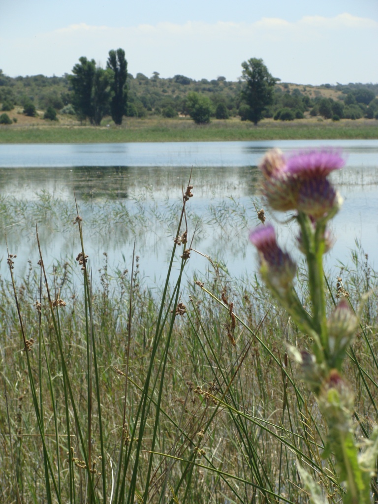 The first of the lakes that make up the chain is known as
Laguna Blanca, because it’s very shallow and the bed is bright white sand. By
first I mean that as the river flows through the area this is the first one it
fills. It’s different from the others, which are mostly karstic formations,
widenings and deepenings in the river created by erosion of the limestone it
flows over. Laguna Blanca is just a shallow basin in the countryside,
surrounded by earth and reeds. It’s also a long way from the nearest village,
and there are no trees to give a bit of shade nor a bar to provide some
civilized relaxation. Even so, there are people who know about it and go there
to escape the crowds.
The first of the lakes that make up the chain is known as
Laguna Blanca, because it’s very shallow and the bed is bright white sand. By
first I mean that as the river flows through the area this is the first one it
fills. It’s different from the others, which are mostly karstic formations,
widenings and deepenings in the river created by erosion of the limestone it
flows over. Laguna Blanca is just a shallow basin in the countryside,
surrounded by earth and reeds. It’s also a long way from the nearest village,
and there are no trees to give a bit of shade nor a bar to provide some
civilized relaxation. Even so, there are people who know about it and go there
to escape the crowds.
The lakes are lower than they have been the last few years.
They are filled not by the river itself but by the water table in the mountains
to the northeast, and it’s been falling because of the lack of rain. Some drain
more quickly than others, because some are little more than pools holding the
runoff from the larger ones, and they dry up sooner.
The other day I passed by on the bike, and stopped to have a
look. The water was very low, exposing what would be a serviceable beach if it
weren’t for the lack of shade. As it is, there was just a bit of very shallow
water in the middle with some puzzled fish swimming around in circles. If I’d
had a net they would have been dinner. As it is, they’ll be eaten by eagles in
a few days.
Such is the life cycle of these lakes. Last for the last
three years Laguna Blanca has been a place teeming with life, dragonflies of
many colours fluttering through the towering reeds and grasses while being
chased by crazed Englishmen with cameras; large and varied waterfowl nesting
and feeding on the succulent algae; birds of prey circling confidently; tiny
flowers dotted all about, breaking the symmetry of the green and white; toads
and frogs splashing in the shallows avoiding children with nets and jam jars.
Now all this is gone, and it’s nearly a desert. It could be several years
before it rises again.
Wednesday, July 25, 2012
More Notes from the Road: Santillana del Mar

 One of the great pleasures of the road is to arrive at a village on foot. You see it first at a greater or lesser distance depending on the terrain, and then you have reference to act as a form of target. You move towards it, as directly as the path will allow you, you begin to make out the spire of the church, the larger houses, the way it is set into the hills around it, the colours of the walls and roofs, the feel of the place, you begin to sense the activity that goes on there, and then to smell it, too, be it cows, fish, industry, machinery, powdered earth or humanity.
Then you are in it, you have a look at anything that seems worth it, you stop for a drink or a bite, you take a few pictures, exchange a few words, and you set out again, leaving it behind as the road takes you onward. The road (the path, the track, it’s all one) dictates your movements. You go where it goes.
On the road you move through places that those who live there think of as fixed. To them they are the centre of the world, at least for a time, but to the caminante it is the village that moves around him, through him, past him. It was before you, now it’s behind you, another spot on the horizon, another reason for wandering.
One of the best places you can arrive at on foot is Santillana del Mar.* If you approach from the coast along the clifftops, which is the best way to do it, you climb into the hills, pass through Arroyo, an olde worlde collection of houses in a little dip with a stream running by (this time the name is quite true) you walk past the Japanese girls with blisters sprawled on the side of the road (I mention this because they’re probably still there; neither of them looked as though they would ever move again), and suddenly you look down on Santillana.
Santillana is almost entirely mediaeval; the central part, which is most of it, consists of 15-16thC wood and stone houses, and cobbled streets, beautifully kept and with few modern intrusions. Cars don’t enter, many of the houses are used as shops and cafés, and the whole effect is of going back to a place from another time, not a museum, a real place that lives and breathes, but without the smell and the hunger.
That’s what you see as you approach Santillana from above, an expanse of brown and black buildings, many like small palaces, the Colegiata, a kind of monastery, another church and cloister, and streets of more modest houses, all looking bright and charming, and on the edge, smallholdings in which cows of the same brown colour chew grass philosophically, all of this set in the beautiful hills of the Cantabrian coast.
It’s worth pausing a moment to enjoy all of this before you enter the town. And that’s why I travel on foot.
*It’s known as the town of the three lies because it is neither holy nor flat nor by the sea (which is what the name would suggest). It would be possible to argue that none of them is strictly false but in any case the place is named for St Juliana of the Sea, who did something Godly several centuries ago and is therefore now buried in a rather nice mediaeval church in the town, the Colegiata.
One of the great pleasures of the road is to arrive at a village on foot. You see it first at a greater or lesser distance depending on the terrain, and then you have reference to act as a form of target. You move towards it, as directly as the path will allow you, you begin to make out the spire of the church, the larger houses, the way it is set into the hills around it, the colours of the walls and roofs, the feel of the place, you begin to sense the activity that goes on there, and then to smell it, too, be it cows, fish, industry, machinery, powdered earth or humanity.
Then you are in it, you have a look at anything that seems worth it, you stop for a drink or a bite, you take a few pictures, exchange a few words, and you set out again, leaving it behind as the road takes you onward. The road (the path, the track, it’s all one) dictates your movements. You go where it goes.
On the road you move through places that those who live there think of as fixed. To them they are the centre of the world, at least for a time, but to the caminante it is the village that moves around him, through him, past him. It was before you, now it’s behind you, another spot on the horizon, another reason for wandering.
One of the best places you can arrive at on foot is Santillana del Mar.* If you approach from the coast along the clifftops, which is the best way to do it, you climb into the hills, pass through Arroyo, an olde worlde collection of houses in a little dip with a stream running by (this time the name is quite true) you walk past the Japanese girls with blisters sprawled on the side of the road (I mention this because they’re probably still there; neither of them looked as though they would ever move again), and suddenly you look down on Santillana.
Santillana is almost entirely mediaeval; the central part, which is most of it, consists of 15-16thC wood and stone houses, and cobbled streets, beautifully kept and with few modern intrusions. Cars don’t enter, many of the houses are used as shops and cafés, and the whole effect is of going back to a place from another time, not a museum, a real place that lives and breathes, but without the smell and the hunger.
That’s what you see as you approach Santillana from above, an expanse of brown and black buildings, many like small palaces, the Colegiata, a kind of monastery, another church and cloister, and streets of more modest houses, all looking bright and charming, and on the edge, smallholdings in which cows of the same brown colour chew grass philosophically, all of this set in the beautiful hills of the Cantabrian coast.
It’s worth pausing a moment to enjoy all of this before you enter the town. And that’s why I travel on foot.
*It’s known as the town of the three lies because it is neither holy nor flat nor by the sea (which is what the name would suggest). It would be possible to argue that none of them is strictly false but in any case the place is named for St Juliana of the Sea, who did something Godly several centuries ago and is therefore now buried in a rather nice mediaeval church in the town, the Colegiata.
Subscribe to:
Posts (Atom)